Friday, January 25, 2013

The Park is Born - 25 January 2007


With the declaration of the Park in August 2005, it was only a matter of time for the Park to be a legally protected entity. 

On 25 January 2007, the Selangor State Government gazetted over 91,144 hectares as ‘state park’ under the National Forestry Act, Selangor Enactment 2005, with the promise to gazette the remaining areas, including the Klang Gates Quartz Ridge, in the near future.  This date, the date the gazette was published, is what TrEES considers the official birthday of Taman Warisan Negeri Selangor. 

It had taken less than 5 years from the start of the “Project to Establish the Selangor State Park” for the Park to become a reality.   The Park is testament to the commitment and focus of all parties involved who were determined to ensure that the Park is protected and would continue to the lifeforce of Selangor, KL and Putrajaya.

In March 2010, the Klang Gates Ridge was gazetted as part of the Park, and the remaining areas after that.  The Park is the third largest park in Peninsula Malaysia, and the Klang Gates Quartz Ridge is believed to be the longest quartz outcrop in the world!

The forests protect some of the state and nation’s most vital natural resources including:
  • The water supply for the state of Selangor, and the Federal Territories of Kuala Lumpur and Putrajaya – the most populated region in the country.  The major rivers in Selangor originate from this area and the Park protects more than 90% of Selangor, KL and Putrajaya’s water supply.  
  • Biodiversity  -- The natural species richness of the Park area includes much of the 3140 vascular plant species recorded for the whole Selangor State; 114 mammal species; 355 birds and over 350 butterfly species.
  • The highlands & unique habitats – the Klang Gates Quartz Ridge, one of the longest quartz outcrops in the world is a significant feature found in the area.  
  • The steep slopes and prevents flooding downstream – The area is essential in regulating surface runoff, minimizing flood peaks and reducing downstream sedimentation.      About 76% of the area lies above an elevation of 300 m, with 9.5% above 1000 m.  Also, at least 50% of this area has slopes greater than 20 degrees, making it unsuitable for most, if not all, types of development.
The area is also one of the few sizeable, multi-use forested areas in close proximity to a major urban area in the world.  In addition to its ecological functions, the forests also are a critical source for relaxation, research and education for residents of Selangor, the nation and the world.

TrEES continues to monitor and submit feedback, letters and opinions on the Park. TrEES is concerned for the Park due to the intense pressure of the urban community that surrounds it and continues to urge the authorities to act quickly to conserve and protect this Park.

Let us all say “Happy Birthday” to Taman Warisan Negeri Selangor, and give thanks for all that the Park gives to us.

Thursday, January 24, 2013

Memories of the Establishment - The Beginning


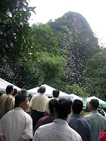
Back in 1995, this is the view from TrEES very first office that inspired us to embark on a quest to protect this ridge and the forests that surrounded it. This is the view that sparked the Selangor State Park.

It began with a gotong royong in 1996 of the recreational site at the foot of the ridge, TrEES working with the residents in the area.  Shortly after, when the draft structure plans for Ampang Jaya were released, TrEES of course had a look at the plans.  We could see the forests behind the ridge, in Hulu Gombak, were linked to a larger body of forest to the north and south.  We then checked the extent of forest by reviewing the draft structure plans for Selayang, Hulu Langat and Hulu Selangor as well.  And we put forward, in our comments to the state government, our idea of gazetting the entire stretch of forest as a state park.

During the public hearing, YB Dato’ Fuad Hassan, the member of Selangor EXCO at that time, expressed interest in our idea.  TrEES was asked to submit a more detailed proposal for the Selangor State Park.  Our concept proposal for the establishment of the Selangor State Park was submitted to the Selangor State Government in 1998.  A big thank you to Dr Wong Khoon Meng for assisting TrEES in drafting the proposal.

The Town and Country Planning Department, Selangor (JPBD Selangor) consequently began investigating the feasibility of the idea.  TrEES did not stop its efforts but continued pushing for the establishment of the Park.  In 1999, TrEES launched a signature campaign to demonstrate to the state government the public’s support and interest in establishing the Park.  TrEES collected over 5,000 signatures (thank you to our volunteers who helped us achieve that!).  TrEES also networked with the local media to highlight the importance of the area.

In 2000, with a small grant from WWF Malaysia, TrEES, with the assistance ERE consultants, produced and submitted a detailed report to various members of the State Government on the critical importance of establishing the Park.  With this detailed report, TrEES met with various members of the state Executive Council to lobby for the establishment of the State Park.

In 2002, TrEES attended a meeting on the Selangor State Park chaired by Y. Bhg. Datin Paduka Dr. Halimaton Saadiah, Director of the Town and Country Planning Department, Selangor (JPBD Selangor) who was also interested in getting the Park established.  In the meeting, when none of the other government agencies or NGOs present took up her request to head a study to establish the Selangor State, TrEES volunteered to partner JPBD Selangor to undertake the study.  To show our commitment and seriousness, TrEES stated that we would also raise half the money required to do the study. Subsequently, TrEES submitted our proposal in writing to JPBD Selangor for consideration by the Selangor State Government.   

To our great delight, a few weeks later, TrEES was informed by Y Bhg Datin Paduka Dr Halimaton that the state had appointed JPBD Selangor and TrEES to facilitate the ‘Project Towards the Establishment of the Selangor State Park.’ With that, TrEES focused on raising our half of the funds needed for the project.  A big thank you to the British High Commission for providing TrEES most of the funding, enabling us to start the project.


From 2003 to 2005, TrEES and JPBD Selangor worked with government departments and other NGOs.  The support and assistance from the government agencies were instrumental in ensuring that the project achieved its objectives.  With their support and assistance, TrEES team, that included technical advisors Dr Rajen, Dr Wong, Dr Yong, Professor Shahwahid, Dr Lee Jin, Dr Siva and Prof Zubaid, produced the report to support the proposal for the 107,000 ha Selangor State Park.    The findings were presented to The Majlis Tindakan Ekonomi Selangor, chaired by the Menteri Besar YAB Dato Sri Dr Mohamad Khir bin Toyo.

In 27 August 2005, the then Deputy Prime Minister, Dato' Sri Haji Mohammad Najib bin Tun Haji Abdul Razak together with the Menteri Besar declared the establishment of the 107,000 ha Selangor State Park.

TrEES is very grateful to everyone who participated in the project.  The park would not be a reality without you all!

Monday, January 21, 2013

TWNS Will be 6 Years Old this 25 January!


Come 25 January, Taman Warisan Negeri Selangor (TWNS)  will be celebrating it's 6th birthday.

Over 85,000 ha of largely contiguous forest along the eastern border of Selangor, was gazetted by the Selangor state government as a 'state park' on 25 Jan 2007. The remaining areas were gazetted after 2010.

The Park, stretching from Hulu Selangor at the northern tip of Selangor State, through Gombak, down to Hulu Langat in the south, is one of the few sizeable, multi-use forested areas in close proximity to a major urban centre in the world.

During the weekends, the Park is a hub of activity as thousands of visitors flock to the popular recreational spots to enjoy various activities including swimming in the many rivers that bisect the Park, trekking, bird watching, cycling and photography.

In conjunction with the Park’s 6th birthday, join us as we take a trip down memory lane...how the Park was established and why it is so important to us all. We would love to hear some of your stories on the Park, too.

Sunday, January 6, 2013

Same Old Story


'In the aftermath of the shocking wall collapse in the posh Bukit Setiawangsa ... DBKL will go in search of all such structures to draw up a hazard map.'  ...Was it really that shocking the wall collapsed - it was so steep and massive!  This should remind us of the June 2011 tragedy in Hulu Langat, and the on going concern of residents across the country.

I pulled out a few highlights from our earlier blog entry, after the June 2011 tragedy. 

From information gathered in the newspapers an estimated 58 housing estates in Kuala Lumpur and Selangor situated in hilly areas face the risk of landslides, based on a Public Works Department (PWD) study last year, in 2010. 

According to the papers, the study shows that all 58 housing estates are situated within four local council areas, namely Kuala Lumpur City Hall (DBKL), Ampang Jaya Municipal Council (MPAJ), Kajang Municipal Council (MPKj) and Selayang Municipal Council (MPS).

The highest number of areas at risk, 39, are listed under MPAJ.  Among the areas sited as highest risk include Bukit Antarabangsa, Taman Melawati, Kampung Pasir, Taman Wangsa Ukay, Ukay Heights, Ukay Perdana, Kampung Tengah, Taman Keramat and Sering Ukay.

Based on the disappointing outcome of the Highland Tower court case, it was re-affirmed, in court, that the local councils cannot be held liable for any tragedy that may result from the council’s approvals of any development.
  
What has happened to these high risk areas identified back in 2010, and where are they exactly? Will the new studies to be drawn up by the government utilize these existing studies and information?  Why do we keep conducting studies to find a solution only after another crisis has taken place?

It is no wonder residents are against developments such as the KL Outer Ring Road and other hill slope developments, especially those that are ‘up-slope’ of existing homes and neighborhoods.

It is unfair to keep telling us that current technology is safe, when ‘current technology’ that was used 10 years ago is now declared to be unsafe, at the fault of no one. What real changes are being made to rectify these persistent problems, to ensure the safety of the community and the environment?